THE SNOW LEOPARD
TRACK

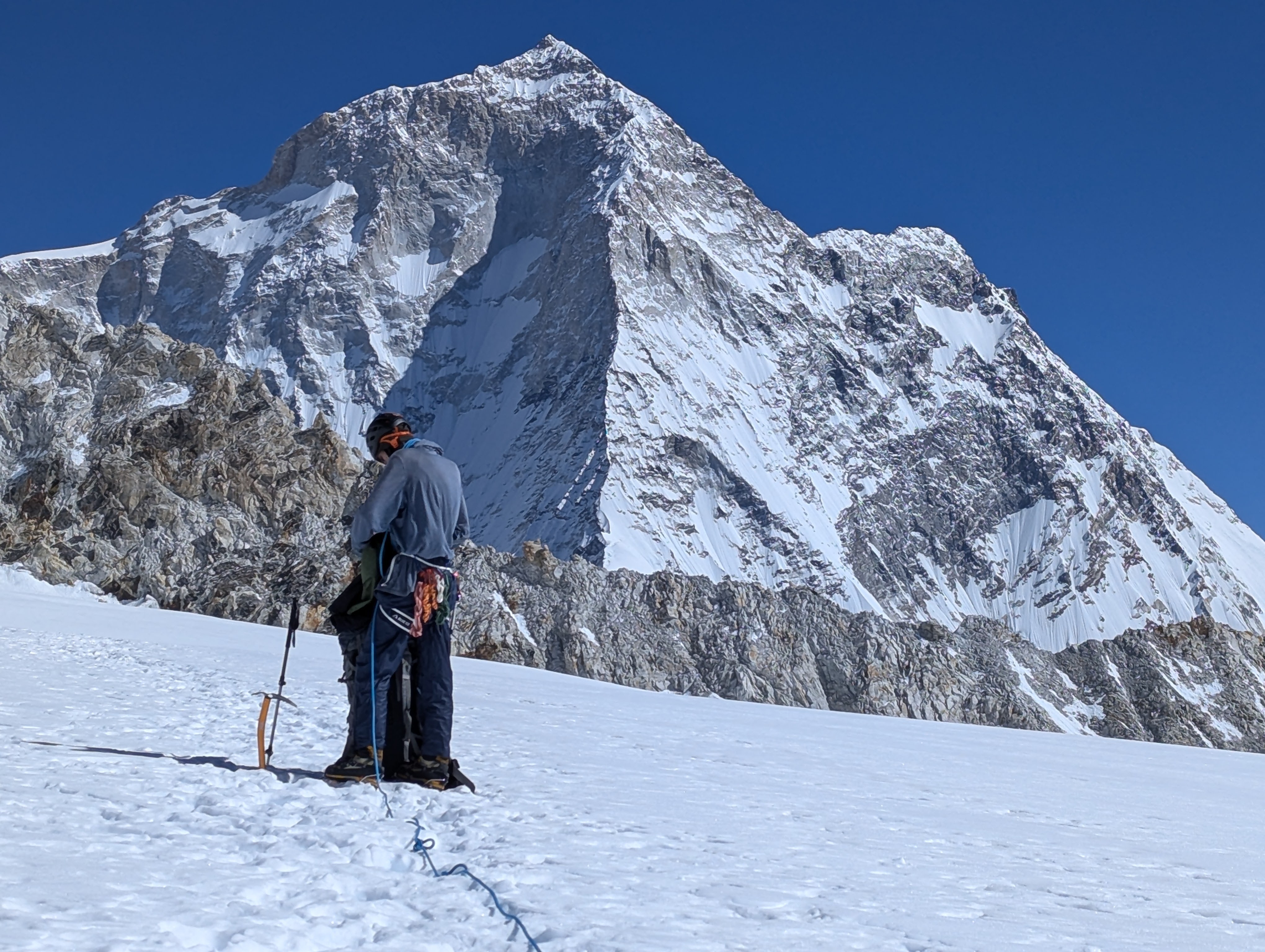
Comprising an 11,300km network of shepherding paths, alpine passages, and old byways, the Snow Leopard Track makes a nearly continuous traversal of Asia's greater ranges. First rising from the massifs of the southeastern Himalayan arc, the trail threads monestary-studded canyons and barrens of the Transhimalaya, passes through the shadows of Karakorum giants, plunges into the desolation of the Inner Pamir, then finally resolves in the vast floral steppes and tundras of the Tian Shan.

11,300km Distance
740km Vertical
552days Trekking
68 Stages
2167 Snow Leopards

The website is currently a work in progress, and will be updated regularly with completed section information

Request GPX Files

Tailing the Ghost

The Snow Leopard Track is an ambitious conceptual route that traces a high traverse between Eastern Nepal and Northern Kyrgyzstan. The trail seeks the wildest passages through the terrain therein, ranging along its course through desolate high-altitude deserts, dense subtropical rainforests, vast icefields, serpentine waterways, and verdant alpine pastures. Trekkers who set out upon the SLT are swiftly ushered into the sublime realm of Asia's greater mountain ranges.

The trail's nature is circumambulatory and reverential, favoring routes unspoiled over those direct. In it is a will to foster conscious stewardship of the delicate ecosystems through which it passes. By encouraging a passion for these places enjoyed mutually by those who visit as well as those who dwell, it is my hope to ignite broader conservation efforts across these landscapes.

Like the eponymous snow leopards from whom this route derives its inspiration, the trail is committed, perhaps relegated, to the highest attainable ground. Without such places both the leopard and the trail cease to be.

Ian Roth in the mountains
Ian Roth The Architect of the Snow Leopard Track
Organized By Great Goat Expeditions

2026 Itineraries

Terskey
Kyrgyzstan
$1,200

Terskey Ala-Too Traverse

Traverse Kyrgyzstan's most iconic mountain range in the Northeast. Cross high-altitude passes, marvel at turquoise glacial lakes, and wander through the pristine forested valleys of the Terskey Ala-Too.

18-28 Aug 2026
11 Days
Strenuous
Max 8 Pax
View Itinerary
Enilchek
Kyrgyzstan
10% off until Mar 15 2026
$1,500

Celestial Peaks of Kyrgyzstan

Journey to Kyrgyzstan's far-east, deep within the Central Tien-Shan, for an incredible expedition to the foot of the country's highest giants: Peak Pobeda (7439m) and Khan Tengri (7010m).

03-15 Sep 2026
13 Days
Strenuous
Max 8 Pax
View Itinerary
Wildlife Observation

Wildlife Catalog

Catalog Species
Upload Pics
Map Data

Our Partners

Frequently Asked Questions

No. There are too many factors to and the breadth of the trail is too great to bother waymarking it. Conditions shift constantly in this part of the world. While it links existing shepherd trails and old trade routes, vast sections (especially in Tajikistan and Pakistan) are cross-country and require advanced navigation skills. At the time of writing (Jan 2026) more than 70% of it has been personally confirmed to be traversable by the founder, Ian Roth, and co. A healthy sense of direction and reliable trail beta are of more value here than waymarkers.

Absolutely. You will typically need standard visas for all 7 countries. The time, effort, and cost investment for this will vary greatly from one country to the next, and depending on your citizenship. Furthermore, specific border zone permits (GBAO in Tajikistan, Border Zone Permits in Kyrgyzstan, Restricted Area Permits in Nepal, PAP and Forest Permits in India, NOC in Pakistan etc.) are required for legal passage through many regions. Pakistan and India are particularly congested with bureaucratic bloat, and while it is tentatively possible to transgress some of these regulations, and many of them on the ground tend to be 'interpretive,' it is not recommended to do so. Begin preparation for this well in advance (especially Pakistan).

The window varies wildly from south to north and between regions, but generally favors a northbound orientation. In Nepal, the prime season usually runs from March through May and from October through November, with shoulder seasons experiencing severe cold or heavy monsoonal rain. The Indian Himalaya reflects this, but the season is shifted somewhat closer to a conventional northern hemisphere summer, as the monsoon effect is slightly tamer than in Nepal, while the winters are earlier and more severe. The Trans-Himalaya around Ladakh and Kashmir experience a markedly more continental climate, with the prime season running from June to September. Across Pakistan, Afghanistan, and Tajikistan the season improves as summer progresses. The window for the high Karakorum is especially short, and the icefields are typically only navigable between June and August or September, with increasing risk of snowfall into the shoulder seasons. Tajikistan, on the other hand, enjoys a dry, cold September and October, and many of the wild rivers there are only passable in these two months. Kyrgyzstan and Kazakhstan exist just outside the scope of this trend, and the season in the Tian Shan and Alay is as long as the region is diverse. Conveniently, the south begins melting out as early as late May, while the north peaks around August. The high passes are generally snow-free until mid to late September.

Contact Form

Command Center

W
A
S
D
Pan Map
Navigate Map / Stage / Photo
ENTER
Open Stage Drill Down / Return
E Quick Expand
SPACE Zoom In
SHIFT Zoom Out

Expanded View Mode

Next / Prev Switch Stage or Region
ENTER
Drill Down Country ↔ Stage Details
C

Sidebar

F

Fullscreen

R

Reset

ESC

Back / Close